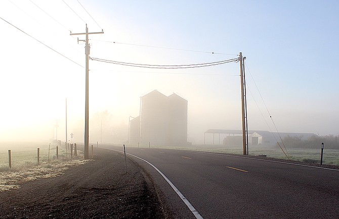
The Settelmeyer silos along Genoa Lane loom in the fog on Monday morning.
Photo by Kurt Hildebrand.
Sunday’s thunderstorms in Carson Valley left rain in spots and generated a fog bank on Monday morning.
Minden weather watcher Stan Kapler reported .13 inches of rain as storms rattled around Carson Valley on Mother’s Day.
Precipitation totals varied wildly with Fredericksburg resident Jeff Garvin reporting .04 inches while a spot a mile north of Genoa recorded .4 inches.
Forecasters say that warming temperatures this week will increase snowmelt and cause streams and rivers to rise across the region.
“Most areas will be dry Monday through Wednesday before shower and thunderstorm chances come back Thursday afternoon through the weekend.”
Forecasters are anticipating that warmer weather will accelerate snowmelt resulting in the Carson and Walker river forks reaching flood-level flows. Heavy showers, should they occur, could increase streams and flows.
“The East Fork of the Carson River near Gardnerville will see oscillating flows, with the river hitting monitor stage Monday night through Wednesday before hitting minor flood stage Thursday into Friday,” National Weather Service Reno Meteorologist Dawn Johnston said on Monday.
Increased flow in both forks should cause river to rise in Carson City later this week.
Previous Story
Mother Nature may celebrate Mother’s Day with a light show as thunderstorms may bring heavy lightning, high winds, rain and hail to parts of Western Nevada this afternoon, according to a statement issued by the National Weather Service in Reno.
“A unique weather pattern unfolds today,” said National Weather Service Reno Meteorologist Dawn Johnston.
Forecasters warn that scattered thunderstorms are possible this afternoon and evening thanks to low pressure drawing in moisture from the Pacific.
“Keep your eyes on the sky today and limit outdoor recreation activities before 10 a.m. to be safe,” Johnston said. “When thunder roars, head indoors.”
According to the statement issued early Sunday morning, thunderstorms will start forming before lunchtime in the mountains south of Highway 50 and then move northward over Western Nevada before dissipating around 11 p.m.
The system will bring the forecast high temperature today down to 74 degrees, which is 3-8 degrees cooler than Saturday, but it’ll change by Monday with drier conditions and highs into the upper 80s.
A climate forecast issued on Saturday for late next week shows temperatures will reach above average levels as a heat dome builds in the Northwest. The same forecast shows above average precipitation reaching into Western Nevada.
Forecasters have predicted high temperatures will climb above the mid-80s.
Warm temperatures will continue to melt the record Sierra snowpack that feeds both forks of the Carson River, with a flood advisory issued for the West Fork of the Carson River at Woodfords.
The West Fork crested at 13.59 feet at 12:05 a.m. Sunday. The river is expected to remain above the 12.5 action stage through today before rising again to 13 feet at midnight.
Snow telemetry at Carson Pass shows that there is still a record amount of water locked in the snowpack, at 51.5 inches on Friday. That tops the previous record set in 2005 of 49.5 inches for the date.
Ebbetts Pass at the top of the East Fork has dipped down to 74.7 inches as of Friday, which is just under an inch below the record 75.6 inches set in 1995.
The East Fork at Horseshoe Bend continues to remain below the action stage at 12.61 feet at 3:10 a.m. according to the Advanced Hydrologic Prediction Service. Forecasts that the river would exceed the action stage this morning were off by nearly a foot as the snowpack that feeds the river remains remarkably resilient.
But that won’t last through the forecast warm temperatures and the East Fork could rise quickly once the snow in the upper elevations begins to melt.
According to a graphic posted by weather.gov/flood, before rapid melting can occur the snowpack as a whole needs to be warmed to 32 degrees.
“Strong winds and high dew point temperatures aid in melting by limiting the effects of evaporative cooling and allow the layer directly above the snowpack to remain warm due to turbulent mixing,” according to meteorologists. Any rain that falls on snowpack can accelerate melting.

Comments
Use the comment form below to begin a discussion about this content.
Sign in to comment