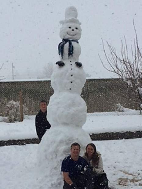
Dallin, Austin and Kendall Shaffer spent their snowday erecting a massive snowman Friday in Carson City.
If you don’t believe in miracles, it might be time to start, because a March Miracle-type storm happened last week.
“In terms of how much precipitation we’ve had down here, we’ve had a lot. It’s almost at the same rate as it was during the miracle March of 1991. So we’re on that rate, but we probably won’t catch up to the record. We’d need three or four more storms in just 12 days,” said Chris Johnston, meteorologist for the National Weather Service.
This past week’s storm rolled in on Wednesday, and was at its strongest Thursday through Saturday. Over that period, Carson City received 12 to 15.5 inches of snow. Reno had about the same. Tahoe at just lake level on the northside recorded 56 inches from March 13 to the end of the storm on March 17, and the westside of the lake got 52 inches. Squaw Valley Alpine Meadows reported at the top of the mountain it recorded more than 100 inches of snow. Minden has 5.5 inches recorded since March 13.
Johnston explained Thursday night through Friday an upper level jetstream, an area of increased wind stream for more than 36 hours. came over western Nevada, and that allowed for a lot of lift in the atmosphere, causing cooling, which created a perfect atmosphere for snow — this is why the area got so much.
The forecast for the upcoming weeks is more tame.
Beginning late Wednesday night it looks like rain will start up again, which will last through Friday morning. That will be the brunt of the main storm. The mountains will get some more snow out of it.
Friday into Saturday there’s a chance of snow on the valley floors, but currently it’s only looking to be an inch or less.
“Were still five or six days out, so things can change. This storm is nothing like the last one, it’s coming out of the tropics and it’s very warm. Snow levels will start at 7 thousand feet, but should lower by Friday. It’s mostly going to be a rain event down here on the valley floor,” said Johnston.
Temperatures for this week are going to hover around the 50s and then start dropping into the lower 40s and below come this weekend. During the nighttime, it’ll reach freezing starting Thursday night and through the weekend.