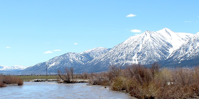
The East Fork of the Carson River was fairly full just south of Muller Lane on Saturday.
With high temperatures forecast to climb into the 80s on Friday, the National Weather Service has issued a flood watch for snow melt starting 5 p.m. Thursday.
“Near record high temperatures Thursday through Sunday will bring significant streamflow rises, especially for snow covered terrain below about 8,000 feet,” according to the watch issued Monday afternoon. “Rises will likely increase daily through the weekend following a diurnal melt cycle with the highest flows often in the evenings and overnight. Minor mainstem flooding is currently forecast along the Forks of the Carson River beginning late Friday. The Susan and Walker Rivers will also need to be closely monitored as flooding cannot be ruled out.”
The flood watch includes the entirety of Douglas and Mono counties and extends all along the Sierra where the snowpack continues to exceed records in many locations.
According to the California Nevada River Forecast Center, the East Fork of the Carson River at Horseshoe Bend is predicted to hit 14.3 feet at 5 a.m. Saturday.
The river has been rising and falling as snow melts in the mountains during the day and it arrives in Carson Valley the next morning.
Cool temperatures overnight on Monday resulted in a half foot difference between the actual reading and the forecast crest of 12.8 feet.
The West Fork at Woodfords is expected to crest at minor flood level of 13.5 feet 2 a.m. Saturday. It crested at 12.77 feet at midnight Monday, above the 12.5-foot action stage.
The Carson River’s two forks join just south of Genoa Lane and within sight of the Willow Bend neighborhood where residents are preparing.
The combined flow of the two forks is anticipated to reach action stage just south of Prison Hill in Carson City at midnight Friday.
Rivers and streams swollen by melt-off are expected to be unusually chilly.
“Anyone participating in outdoor recreation this weekend should use caution as water will be running high, fast, and potentially out of banks for some creeks and streams,” forecasters said. “The water will be extremely cold as well, quickly causing shock.”
The high temperature in Minden is forecast to reach 82 degrees on Friday, three degrees short of the 85-degree record set in 2007. That was a warm year with the record for April 29 at 88 degrees. The high on Saturday is forecast to reach 84 degrees.