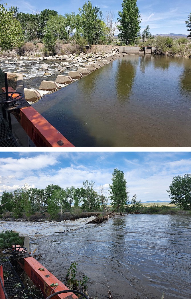
A diversion dam on the East Fork last year and this in two photos taken by Gardnerville resident Christine Mills.
Genoa, Nev. — Snowmelt in the mountains prompted Gov. Joe Lombardo to declare a state of emergency for counties in the Carson, Walker and Truckee river basins, including both Douglas and Lyon counties. Yerington has been awash thanks to the snowpack melting above the Walker.
According to the governor’s office flooding impacts could continue seven weeks into late July, which is not a bad bet. Only a third of the snowpack at Ebbetts Pass at the top of the East Fork melted since May 1 and 53.4 inches of water is still locked in the snowpack.
A flood watch remains in effect for most of Western Nevada through 9 p.m. today for flooding from possible thunderstorms. While it rained on Memorial Day, the East Fork didn’t notice as it continued to bump along around the 13-foot action stage.
The West Fork, while just reaching minor flood stage, is also remaining fairly steady. As of 5 a.m. today, telemetry at Forestdale Creek showed the snow was just an inch short of 7 feet with 50.5 inches of snow yet to melt.
Memorial Day’s rain appeared to center on the mountains with .3 inches at Hagen’s Meadow and .27 inches in Markleeville. A gauge south of Topaz Lake recorded .28 inches. Fredericksburg resident Jeff Garvin said he got .11 inches, which is similar to what I got across two squalls.
Expect more of the same today, with the odds for precipitation up around 80 percent this afternoon. The high is forecast to hit 75 degrees with the west wind 10-15 mph.
Kurt Hildebrand is editor of The Record-Courier. Contact him at khildebrand@recordcourier.com or 775-782-5122.