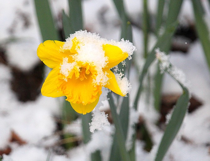
Light snow fell in Genoa overnight generating the iconic snow on a daffodil on Sunday morning.
Photo by Kurt Hildebrand.
Around 15 inches of snow was added to the snow depth at Heavenly Valley over the course of 24 hours, according to National Resource Conservation Service telemetry located at 8,533 feet.
The first snowstorm of spring 2024 brought some snow to Carson Valley after dropping around a half inch of rain along the foothills south of Genoa on Saturday.
Chain controls were in effect over Kingsbury Grade and Spooner Summit for the second morning in a row on Sunday.
Kingsbury didn’t appear quite so icy as it was on Saturday morning, but there weren’t any reports of weather-related collisions.
Blowing snow hit Genoa on Saturday afternoon, around the same time a blue Geo Tracker rolled off Foothill Road and landed on the trail between David Walley’s and town.
The vehicle’s driver was transported to Renown Regional Medical Center via East Fork ambulance as a result of the collision reported around 3:30 p.m. A blue heeler riding in the vehicle is reportedly missing and residents are asked to be on the lookout for the dog.
Otherwise, the blustery light snow was taken in stride by Genoans and other Foothill residents, with a bicyclist making his way north on Foothill Road near Muller despite the flurries.
With irrigation season only eight days away, the storm provided a welcome snow pack booster to the late winter storms on Washington’s Birthday and Leap Day weekends.
Forestdale Creek, not far from Carson Pass at the top of the West Fork of the Carson River, was at 110 percent median snow water equivalent. With 35.3 inches at the snow telemetry site, it was running 3.3 inches above April 1 median peak.
That’s better than Ebbetts Pass at the top of the East Fork, where 29.9 inches of snow water was recorded at the telemetry site, around 90 percent of median.
The site’s median peak is 35 inches on April 8, but with more weather expected through the next week, it’s possible it will nudge a little closer.
The entire Carson River Basin is at 105 percent median as of Sunday morning. The Truckee Basin, which include Lake Tahoe, was at 102 percent while the Walker Basin, including Topaz Lake, was at 98 percent.
Those are significant improvements over the beginning of 2024.
On Thursday, the drought monitor showed a band of abnormally dry conditions running southeast through mid-Washoe County and into north and central Lyon County, skirting northeastern Douglas County on its way into Mineral County.
This weekend’s storm may see some modification, though not to the level of winter 2023’s drought killers.
A winter weather advisory expires at Lake Tahoe at 11 a.m. today. Mono County could see additional snow showers through this afternoon with 1-3 inches forecast in lower elevations and around 5 inches in higher locations.
Snow showers are forecast to continue until around 2 p.m. before converting to rain under mostly cloudy skies and 5-10 mph winds shifting to the northwest. Less than half an inch of snow is expected in the Valley.